Cookie policy
This website uses cookies to improve your experience while you navigate through the website. Out of these, the cookies that are categorized as necessary are stored on your browser as they are essential for the working of basic functionalities of the website. We also use third-party cookies that help us analyze and understand how you use this website. These cookies will be stored in your browser only with your consent. You also have the option to opt-out of these cookies. But opting out of some of these cookies may affect your browsing experience.
Always Active

Necessary cookies are required to enable the basic features of this site, such as providing secure log-in or adjusting your consent preferences. These cookies do not store any personally identifiable data.

No cookies to display.

Functional cookies help perform certain functionalities like sharing the content of the website on social media platforms, collecting feedback, and other third-party features.

No cookies to display.

Analytical cookies are used to understand how visitors interact with the website. These cookies help provide information on metrics such as the number of visitors, bounce rate, traffic source, etc.

No cookies to display.

Performance cookies are used to understand and analyze the key performance indexes of the website which helps in delivering a better user experience for the visitors.

No cookies to display.

Advertisement cookies are used to provide visitors with customized advertisements based on the pages you visited previously and to analyze the effectiveness of the ad campaigns.

No cookies to display.

Skip navigation

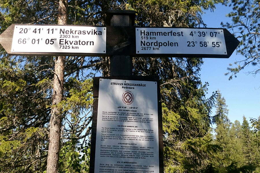
The Struve Geodetic Arc is a chain of survey triangulation measurements stretching from the Arctic Sea to the Black Sea, through ten countries and over 2,820km. These are points of a survey, carried out between 1816 and 1855 by the astronomer Friedrich Georg Wilhelm Struve, which represented the first accurate measuring of a long segment of a meridian. This helped establish the exact size and shape of our planet and marked an important step in the development of earth sciences and topographic mapping. It is an extraordinary example of scientific collaboration among scientists from different countries, and of collaboration between monarchs for a scientific cause. The original arc consisted of 258 main triangles with 265 main station points. The listed Unesco World Heritage site includes 34 of the original station points, with different markings, i.e. a drilled hole in rock, iron cross, cairns, or built obelisks.

The Struve Geodetic Arc is a UNESCO World Heritage Site. Six of the station points that have been selected to represent the entire Arc on the World Heritage List are located in Finland. The station points have historical importance, but they also offer excellent views of the surrounding area.

The Struve Geodetic Arc has also been called the Russo-Scandinavian meridian measurement, because originally the Arc remained within two empires.


Website (URL): https://blogi.eoppimispalvelut.fi/struvenorth/

Heart